A Guide to Exploring the Kingdom of Wonder with Cambodia Map
Explore the Kingdom of Wonder with our detailed Cambodia map, guiding you through the country's rich history and vibrant culture.
Maps have always been essential tools for understanding geographical boundaries, exploring new territories, and planning journeys. They show us pictures of the world around us, which helps us understand how places are organized, find our way around places we've never been before and plan our trips more efficiently. As digital technology has grown, it has become easier than ever to get detailed and accurate maps. This gives travelers quick access to information.
Often referred to as the "Kingdom of Wonder," Cambodia is a land rich in history, culture and natural beauty. From the ancient temples of Angkor to bustling urban centers and serene rural landscapes, Cambodia has something special to offer every kind of tourist. A good map, whether it's printed, digital or interactive, is essential for getting around and finding the country's many hidden gems because it is so geographically and historically varied.
This guide explores how different types of Cambodia maps can enhance your travel experience, making every journey smoother, safer and more enriching. We will cover historical maps that showcase Cambodia's past, digital maps that provide real-time navigation, and practical maps for businesses and tourists alike.
The right arrangement can be your best friend whether you are discovering the grandeur of historical sites, the liveliness of cities or the peace and quiet of the country. By learning how to properly utilize these monitoring tools correctly, tourists and businesses in Cambodia can better plan their trips, become an understanding of the country's heart, and connect regarding it.
Cambodia Map Overview
Understanding Cambodia map technology is the first step to a successful exploration of the country. A Cambodia map provides a bird’s-eye view of the nation, showing its provinces, cities, roads, rivers, mountains, and other natural features. Maps are essential for travelers, researchers, urban planners and locals alike, as they offer both practical navigation solutions and insight into Cambodia's geography.
Cambodia is a country of diverse landscapes, from bustling urban centers to serene countryside and untouched natural areas. A detailed map helps users visualize these regions, understand spatial relationships and plan trips with accuracy. Whether you are organizing a sightseeing journey to ancient temples, analyzing demographic trends, or exploring rural provinces, maps are indispensable tools for exploration and learning.
Cambodia Map 2026
The Cambodia map 2026 represents the most up-to-date depiction of the nation’s geography, reflecting ongoing changes in administrative borders, urban growth, and infrastructure development. As Cambodia continues to modernize and expand its cities, roads and economic zones, an updated map has become indispensable for travelers, researchers, businesses and locals alike.
Comprehensive Overview
This map provides a detailed overview of Cambodia’s landscape, highlighting not only its cities and provinces but also its natural, cultural, and economic features. By studying the Cambodia map 2026, users can gain a full understanding of the spatial distribution of major urban centers, rural communities, rivers, mountains, coastal areas, and national parks.
Key Features of Cambodia Map 2026
Provinces and Capitals
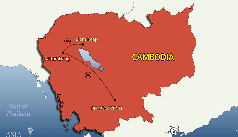
Cambodia consists of 25 provinces, each with its administrative capital. The map clearly marks all provincial boundaries and centers, providing essential information for governance, travel, and logistics. Provinces like Siem Reap, Kampong Cham and Battambang are highlighted for easy identification, helping travelers plan efficient multi-province itineraries and researchers study regional demographics.
Major Cities
The map features all significant urban hubs, including Phnom Penh, the capital; Siem Reap, home to Angkor Wat; Battambang, known for colonial architecture and cultural heritage; Sihanoukville, Cambodia’s primary coastal city; and other emerging cities.
These urban areas are carefully detailed, showing major streets, commercial districts, transportation hubs and nearby attractions. For tourists and business professionals, this helps in understanding city layouts, accessibility, and connectivity between different regions.
Road Networks
With Cambodia’s infrastructure evolving rapidly, the road network is a critical component of travel planning. The Cambodia map 2026 clearly marks major highways, secondary roads, rural pathways, and bridges, helping travelers navigate efficiently.
Whether planning a road trip through the Cardamom Mountains, traveling from Phnom Penh to Siem Reap or exploring remote villages, the map provides accurate routing information. It also assists logistics companies and delivery services in route optimization.
Natural Features
Cambodia’s rich natural landscape is captured in detail, including major rivers like the Mekong, Tonle Sap and Bassac River. Mountain ranges such as the Cardamom and Dangrek Mountains are highlighted for trekking, eco-tourism and conservation studies. National parks, protected forests, and coastal areas like Koh Kong and Sihanoukville are clearly marked, supporting travel planning, environmental research and outdoor adventure activities.
Cultural and Historical Landmarks
The map also integrates important cultural and historical sites, including temples, palaces, and UNESCO World Heritage Sites. Angkor Wat, Phnom Penh’s Royal Palace, and other iconic locations are pinpointed, making the map an essential resource for tourists, historians and travel agencies.
Benefits of Using Cambodia Map 2026
- Travel Planning: Tourists can efficiently plan trips across multiple provinces, navigate cities and locate key landmarks.
- Educational Use: Students, geographers, and researchers can analyze urbanization trends, population density and regional development.
- Business and Logistics: Companies can map supply chains, delivery routes and regional hubs with precision.
- Cultural Exploration: Travelers and locals alike can discover temples, markets, national parks and scenic routes with detailed location information.
- Safety and Navigation: Accurate road networks, bridge locations, and rural pathways enhance travel safety, especially in remote areas.
The Cambodia map 2026 is not just a tool for navigation it is a comprehensive guide to understanding the country’s evolving geography, infrastructure and cultural heritage. Whether you are a tourist exploring Cambodia’s ancient temples, a researcher studying regional development a local commuting between cities, or a business professional planning logistics, this map provides accurate, up-to-date, and essential information.
By using the Cambodia map 2026, travelers and professionals can confidently explore, analyze, and engage with Cambodia in ways that are both efficient and insightful. With its detailed representation of provinces, cities, roads, natural features and cultural landmarks, this map remains an indispensable companion for anyone navigating the dynamic and diverse landscapes of Cambodia.
Google Maps Cambodia
Google Maps Cambodia is a modern digital tool that has completely transformed the way people navigate the country. It combines satellite imagery, street-level photography, and interactive mapping features to create an accessible and reliable resource for both locals and visitors. With Google Maps, users gain a comprehensive understanding of Cambodia’s geography, urban development and cultural hotspots all from the convenience of their devices.
Key features include:
- Street View: Virtually explore urban streets, local markets, historic temples, and scenic landscapes. For example, tourists can “walk” around the Angkor Wat complex in Siem Reap or explore the vibrant streets and markets of Phnom Penh before visiting in person. Street View also helps locals familiarize themselves with unfamiliar neighborhoods or plan routes in congested city areas.
- Real-Time Traffic Updates: Avoid congestion and delays with live traffic information. Google Maps highlights traffic jams, construction zones, and accident reports, making it easier to select the fastest routes. Commuters in Phnom Penh, for instance, can avoid peak-hour traffic along Monivong Boulevard, while delivery drivers can optimize routes to reach destinations on time.
- Route Planning: Optimize journeys for driving, walking, cycling, or public transportation. Users can plan detailed multi-stop trips, estimate travel times, and even calculate fuel costs for longer journeys. Tourists traveling from Phnom Penh to Kampot, for example, can plan scenic stops along the way, including national parks or cultural villages.
- Points of Interest: Locate restaurants, hotels, banks, hospitals, shopping centers, and cultural landmarks. Whether you’re searching for a quiet riverside cafe in Siem Reap the nearest ATM in Battambang, or a popular street food market in Phnom Penh, Google Maps provides exact locations, reviews, and directions.
Beyond these features, Google Maps Cambodia enhances travel by offering interactive tools like saving favorite locations, creating custom maps, and sharing routes with friends or tour groups. Its integration with mobile devices ensures that users always have up-to-date information at their fingertips.
For tourists, Google Maps provides the confidence to explore Cambodia independently, whether visiting the temples of Angkor, hiking in the Cardamom Mountains, or relaxing on the beaches of Sihanoukville. For locals, it is equally indispensable for navigating city streets, discovering new businesses, or planning efficient daily commutes.
With its blend of practicality, convenience, and real-time interactivity, Google Maps Cambodia bridges the gap between physical maps and digital navigation, empowering users to explore the country confidently, safely, and with maximum efficiency.
Cambodia Province Map
A Cambodia province map offers a closer look at all 25 provinces, including their respective capitals. Provinces such as Kampong Cham, Prey Veng, and Battambang have unique cultural and natural attractions that are easier to explore with a provincial map.
Key benefits of using a province map include:
- Understanding administrative divisions and local governance
- Planning multi-destination travel routes
- Discovering tourism hotspots, historical sites and natural attractions
- Organizing logistics for business, research or educational trips
For example, travelers planning to visit Siem Reap’s Angkor Wat can coordinate trips from Phnom Penh or nearby provinces efficiently. Researchers analyzing population density, urbanization, or economic zones will find detailed provincial maps an invaluable resource for fieldwork.
Cambodia Road Map
The Cambodia road map highlights all major highways, secondary roads, and local routes. This is essential for planning efficient journeys, whether for a short city commute or a multi-day road trip across provinces.
The road map is particularly useful for:
- Tourists exploring remote areas such as the Cardamom Mountains or Koh Kong
- Travelers driving between cities like Phnom Penh to Battambang or Kampot
- Adventure seekers looking for scenic or off-the-beaten-path routes
Using a road map in combination with digital tools like Google Maps ensures travelers can navigate safely and discover hidden gems that are not typically found in guidebooks. Road maps also show bridges, checkpoints, and ferry crossings, which are crucial for long-distance travel in Cambodia.
Detailed Map of Cambodia
A detailed map of Cambodia goes beyond basic geographic information to showcase topography, rivers, mountains, national parks, and cultural landmarks.
Highlights include:
- Rivers: Mekong, Tonle Sap and Bassac River, essential for transport and fishing communities
- Mountains: Cardamom Mountains and Phnom Aural, ideal for trekking and adventure tourism
- National parks: Botum Sakor, Ream, and Phnom Kulen for wildlife observation and eco-tourism
- Cultural landmarks: Ancient temples, royal palaces and UNESCO World Heritage Sites
Such detailed maps are useful for researchers studying environmental conservation, historians tracing cultural heritage, or tourists seeking immersive experiences in Cambodia’s natural and historical landscapes.
Cambodia Map with Cities
A Cambodia map with cities emphasizes major urban centers and population hubs, including:
- Phnom Penh – the bustling capital with economic, cultural, and historical significance
- Siem Reap – the gateway to Angkor Wat and ancient Khmer temples
- Battambang – a mix of colonial architecture and countryside charm
- Sihanoukville – a coastal city with beaches and port activities
Urban maps help users understand population distribution, urban growth patterns, and tourism infrastructure. They are particularly useful for city planners, investors, and tourists who want to explore cultural districts, markets, and urban developments efficiently.
Detailed Map of Phnom Penh
The detailed map of Phnom Penh provides insights into streets, neighborhoods, landmarks, and public transportation networks. Key features include:
- Historical landmarks: Royal Palace, National Museum, and Independence Monument
- Neighborhoods: Boeng Keng Kang, Toul Kork, and Russian Market area
- Transportation: Main roads, bus routes, and pedestrian-friendly zones
A detailed Phnom Penh map is essential for navigating this fast-paced capital, discovering hidden cultural spots, and planning sightseeing or business trips. It serves both locals who need day-to-day navigation and visitors eager to explore the rich heritage and urban life of Cambodia’s capital city.
Digital Maps Cambodia
Digital maps Cambodia offer interactive features that allow users to zoom, search, and overlay data such as traffic, landmarks and terrain. Digital maps are accessible via smartphones, tablets, or computers, making them highly convenient for both travelers and professionals.
Advantages of digital maps include:
- Real-time updates on traffic and road conditions
- Accessibility from anywhere, eliminating the need for physical maps
- Integration with navigation apps for step-by-step directions
- Ability to mark favorite locations, routes, or points of interest
With digital province maps of Cambodia 2024, users can explore the country virtually before visiting, plan efficient travel itineraries, and gain a deeper understanding of the nation’s geography.
Using Google Maps in Cambodia
Using Google Maps in Cambodia makes navigation and exploration smoother and more enjoyable. Features include:
- Route planning for driving, walking, and public transport
- Street view to preview tourist sites, markets and neighborhoods
- Traffic updates to avoid congestion and delays
- Searchable points of interest for food, accommodation, and attractions
Google Maps enhances every trip, whether you are traveling to historic temples in Siem Reap, exploring Phnom Penh’s vibrant markets, or discovering hidden natural attractions. By leveraging this tool, travelers and locals can experience Cambodia efficiently, safely, and with confidence.
Tips for Exploring Cambodia Using Maps
Combine digital and physical maps – While digital maps are convenient, carrying a physical map can be helpful in areas with poor internet coverage.
- Plan routes in advance – Use road and province maps to plan multi-city trips efficiently.
- Check updated maps – Always ensure your maps reflect the latest changes in roads, provinces and landmarks.
- Use street view – Preview your destination to understand the terrain and surroundings.
- Bookmark key locations – Save hotels, restaurants, and tourist sites on digital maps for easy access during travel.
A Cambodia map, whether digital, detailed or road-focused, is essential for navigating the country efficiently. From exploring bustling urban centers to discovering hidden natural gems, maps provide valuable insight into Cambodia’s diverse geography. Using Cambodia map 2026, Google Maps, and detailed province maps ensures travelers, researchers, and locals can navigate confidently, plan effectively and experience the country fully.
Maps not only help with navigation but also enhance understanding of Cambodia’s culture, infrastructure, and natural beauty. For anyone planning to travel, study, or work in Cambodia, investing time in exploring its maps is a crucial first step toward a successful and enriching journey.
How to Use Google Maps in Cambodia
Using Google Maps in Cambodia and Cambodia map is straightforward. Ensure you have an internet connection, open the app, and type your destination. The app provides step-by-step directions, estimated travel times, and alternative routes. Google Maps will help you every step of the way, whether you're traveling through the busy streets of Phnom Penh or heading out into the countryside, making sure you get to your destination quickly and safely.
Using Google Maps in Cambodia is simple:
1. Open the App: Download and open Google Maps on your device.
For Android: https://play.google.com/store/apps/details?id=com.google.android.apps.maps&hl=en
For IOS: https://apps.apple.com/us/app/google-maps/id585027354
2. Search: Enter your destination in the search bar.
- Directions: Choose the best route based on your mode of travel.
- Street View: Use Street View to preview your destination and surroundings.
- It's a good idea to also keep a physical map as a backup in case of connectivity issues.
Google Maps Cambodia Street View
Google Maps Cambodia Street View allows users to virtually walk-through streets and neighborhoods. This function is especially helpful for getting to know a place before visiting. Google Maps Street View offers a realistic and immersive experience that lets you explore the streets, landmarks, and secret places of Cambodia from the comfort of your home, whether you're planning a vacation there or you're just interested in the area.
Using Maps for Different Purposes
Maps are useful tools with many applications, particularly in a multicultural diverse nation like Cambodia. Every kind of map has its own advantages, especially if it is used for business or tourism, historical research, or seasonal navigation.
Cambodia Map for Tourists
A map of Cambodia that shows the locations of hotels, restaurants, and attractions is very helpful to visitors. It simplifies organizing your trip and guarantees an easy travel experience. A Cambodia map for tourists will direct you to the top attractions and make sure you make the most of your stay in Cambodia, whether your goals are to see the famous Angkor Wat, relax on the beautiful shores of Koh Rong, or explore the lively markets of Phnom Penh.
Cambodia Maps for Business Travelers
Cambodia maps for business travelers focus on commercial hubs, industrial zones, and transportation links. These maps help identify important business areas and help with logistical planning. A business traveler map will give you the information you need to easily traverse Cambodia's business landscape, whether you're meeting with clients in Siem Reap, attending conferences in Phnom Penh, or looking into investment opportunities in Sihanoukville.
Cambodia Travel Maps for Summer
Cambodia travel maps for summer emphasize seasonal attractions, weather patterns, and travel tips. They are designed to enhance the travel experience during the summer months. Whether you're seeking relief from the heat at the waterfalls of Mondulkiri, exploring the lush landscapes of Ratanakiri, or enjoying the vibrant festivals that take place during the summer, a travel map tailored to the season will help you make the most of your summer adventures in Cambodia.
Best Maps for Cambodia's Rainy Season
The best maps for Cambodia's rainy season highlight areas prone to flooding, alternate routes, and safe travel tips during heavy rains. The rainy season in Cambodia offers visitors unique experiences and a plethora of flora, but it also poses certain difficulties. A rainy season map can guarantee your safety and let you make the most of your travels during the rainy season, whether you're planning a journey to the flooded forests of the Tonle Sap or navigating the muddy roads of the countryside.
History and Benefits of Mapping in Cambodia
In Cambodia, mapping has a long history that is entwined with political, cultural, and technological advancements in the nation. The growth of Cambodia map google is reflected in its dynamic history and increasing demand for precise geographical information, as shown in the schematics found in ancient temples and in contemporary computerized maps.
History of Mapping in Cambodia
The history of mapping in Cambodia dates back to ancient times when early civilizations used rudimentary maps to navigate their surroundings. Significant advancements in mapping occurred during the colonial period when European powers sought to understand and control the region.
Ancient and Medieval Periods
1. Angkor Era Maps
- Temple Plans: During the Khmer Empire (9th to 15th centuries), detailed plans of temple complexes like Angkor Wat were created. These plans were used for construction and religious purposes.
- Relief Maps: Carvings and bas-reliefs depicting geographical layouts were common, showcasing the empire's vast territories and significant landmarks.
2. Colonial Period
- French Cartography: In the late 19th and early 20th centuries, French colonial administrators introduced modern cartographic techniques. They created detailed maps for administration, resource extraction and infrastructure development.
- Topographic Maps: The French produced the first comprehensive topographic maps of Cambodia, detailing terrain, waterways, and settlements.
Post-Independence to Modern Day
1. post-Independence (1950s-1970s)
- National Mapping Initiatives: After gaining independence in 1953, Cambodia started its own mapping initiatives, focusing on national development and planning.
- Military and Strategic Maps: During periods of conflict, including the Vietnam War and Cambodian Civil War, maps were crucial for military strategy and operations.
Digital Era (1990s-Present)
- GIS and Remote Sensing: The introduction of Geographic Information Systems (GIS) and remote sensing technology in the 1990s revolutionized mapping in Cambodia. These technologies enabled more precise and comprehensive mapping.
- Google Maps and Online Platforms: The advent of digital platforms like Google Maps has made accurate maps widely accessible. Features like satellite imagery, street view, and real-time navigation have become indispensable tools for both locals and tourists.
Benefits of Digital Maps in Cambodia
In recent years, digital maps in Cambodia have revolutionized the way people navigate, explore and engage with their environment. Compared to traditional paper maps, digital maps offer numerous advantages, including interactive features, real-time updates and detailed geographic information. The integration of digital Cambodia maps has greatly benefited various industries, such as tourism, business, urban planning, disaster management and education. Let’s explore the many benefits these maps bring to Cambodia.
Tourism and Travel
Benefits of digital maps in Cambodia, including digital and interactive maps, provide detailed routes and real-time navigation, making it easier for tourists to explore Cambodia’s attractions. Digital maps provide real-time information on traffic conditions, road closures and construction.
This feature helps travelers plan their routes more efficiently and avoid delays. Mapping historical and cultural sites helps in their preservation and promotes cultural heritage tourism also. Street view technology enables users to virtually explore streets and neighborhoods. This is beneficial for getting a sense of the area before visiting and for locating specific addresses.
Economic Development
Maps can be interacted with by users to obtain comprehensive details on certain locations, including eateries, lodging facilities, and tourism destinations. Easy location sharing and customizable routes are also made possible via interactive elements.
In-depth maps support urban development and planning, which helps control the expansion of cities like Phnom Penh. In order to ensure sustainable development, maps are essential for managing natural resources such as land, water, and minerals. The construction of infrastructure projects, including public buildings, bridges and highways, is guided by precise maps.
Disaster Management and Environmental Protection
In a country prone to seasonal flooding and climate-related hazards, digital maps play a vital role in disaster preparedness and response.
- Risk assessment and evacuation planning: Maps help identify high-risk areas, plan evacuation routes, and monitor disaster-prone zones.
- Environmental monitoring: GIS (Geographic Information Systems) and remote sensing technologies track deforestation, water levels and conservation initiatives.
- Climate adaptation: Mapping vulnerable areas enables authorities to develop strategies to mitigate the effects of climate change and improve resilience.
Digital maps are an essential tool for protecting lives, property, and the environment in Cambodia, ensuring that both governmental agencies and communities are better prepared.
Education and Research
Digital maps also serve as a valuable resource for education and academic research.
- Geography and history learning: Students gain a deeper understanding of Cambodia’s geography, natural features, and cultural heritage.
- Research applications: Scholars use maps for studies in archaeology, ecology, socio-economic trends, and urban development, enhancing the quality and accuracy of their findings.
By integrating digital maps into the classroom and research projects, learners and professionals can access real-time data and interactive resources that enrich the educational experience.
Governance and Administration
Efficient governance and public administration in Cambodia have also benefited from digital mapping technology.
- Local administration: Maps help manage provinces, districts, and communes, improving planning, public service delivery, and electoral processes.
- Land management: Accurate land maps are essential for resolving ownership disputes, planning urban expansion, and regulating land use.
- Infrastructure and service planning: Authorities can make informed decisions regarding transportation networks, utility services, and public facilities.
Digital maps streamline administrative processes, improve transparency, and support effective governance at all levels.
Offline Access
Many digital maps now offer offline functionality, which is particularly useful in Cambodia’s rural and remote areas. Travelers can download maps and navigate without an internet connection, ensuring seamless access to routes and locations even in areas with limited connectivity. This offline feature enhances convenience and safety for both locals and tourists exploring the countryside.
Choosing the Right Cambodia Map
Selecting the ideal map depends on your purpose and preferences:
- Google Maps Cambodia: Provides a comprehensive overview with real-time traffic and street view features.
- Travel-focused maps: Highlight tourist attractions, restaurants, and accommodations.
- Province maps: Offer detailed local insights for travelers seeking adventure beyond popular destinations.
- Business maps: Provide information on commercial zones, infrastructure, and services.
- Historical maps: Fascinate history enthusiasts interested in Cambodia’s evolving geography and heritage.
By choosing the right map, travelers, businesses, and government agencies can navigate, plan, and explore Cambodia effectively. Whether you are a tourist, researcher, or policymaker, digital Cambodia maps offer an invaluable tool for unlocking the country’s potential.
Digital maps have transformed how Cambodia navigates, plans, and grows. From tourism and economic development to disaster management, education, and governance, the advantages are immense. With interactive features, offline accessibility, and real-time updates, digital maps have become an indispensable resource for modern Cambodia.
Conclusion
Maps, both traditional and digital, play a crucial role in understanding and navigating Cambodia. Whether you are a tourist exploring new horizons, a business traveler attending meetings, or a resident discovering hidden gems, having access to detailed and accurate maps can greatly enhance your experience.
With tools like Google Maps Cambodia, a comprehensive Cambodia map, or a precise Cambodia road map, the right resources can transform the way you explore the country.
Beyond simple navigation, modern mapping technology offers insights into local culture, landmarks, transportation routes, and regional connectivity. By leveraging these tools, you gain not only efficiency but also a deeper understanding of Cambodia’s geography, history, and lifestyle. From the bustling streets of Phnom Penh to the serene temples of Angkor and from the scenic countryside to coastal escapes, maps can guide you every step of the way.
Investing time in choosing the right maps ensures smoother travel, better planning, and a richer overall experience. They act as your personal guide, helping you uncover hidden attractions, avoid unnecessary delays and make informed decisions on the go. In a country as diverse and vibrant as Cambodia, maps are more than just directions they are your gateway to discovery, adventure and meaningful connections.
So, whether navigating the urban hubs, rural landscapes, or historical treasures, equip yourself with reliable maps and embark on an unforgettable journey through the Kingdom of Wonder. Let every street, every river, and every temple reveal its story, and let the power of maps transform your travel experience into one filled with insight, excitement, and adventure.
Let's explore theTechnology in Cambodia.
More Articles
 22 Jul 2026
Passkeys vs Passwords: Security Comparison
Discover how passkeys compare to traditional passwords, learn how passwordless authentication works, and find out which option offers better security for protecting your online accounts.
 17 Jul 2026
Rust vs Go: Which Language Is Better in 2026?
Compare Rust vs Go in 2026, including performance, backend development, memory safety and the best language for your projects.
 15 Jul 2026
What Is Synthetic Data? Benefits, Uses & Examples
Understand synthetic data explained, its benefits and real-world AI examples that improve privacy and machine learning.
 14 Jul 2026
Best Mobile Networks in Cambodia (2026 Guide)
Discover the best mobile networks in Cambodia in this 2026 guide. Compare coverage, speed, pricing, and find the best SIM card in Cambodia for tourists, travelers, expats, and residents.