Remote Sensing Technologies for Industry & Agriculture
Explore how remote sensing technologies—ranging from LiDAR and hyperspectral imaging to UAV drone systems—are revolutionizing industry and agriculture through advanced data analytics, GIS integration, and environmental monitoring.
Introduction
In recent years, remote sensing technologies have become indispensable tools for industries and agriculture alike. By collecting data from satellites, aircraft, drones, or ground-based sensors, these technologies allow users to observe, measure, and analyze the Earth’s surface without direct contact. They deliver real-time insights into land use, vegetation health, infrastructure, and environmental changes—driving smarter decision-making across sectors.
From monitoring crop growth to assessing mineral resources, remote sensing is a cornerstone of the digital transformation sweeping through industry and agriculture. Its combination of precision, scalability, and automation is setting new benchmarks for efficiency and sustainability.
Understanding How Remote Sensing Works for Industrial Use
Remote sensing operates by detecting and measuring radiation reflected or emitted from the Earth’s surface. Sensors aboard satellites, aircraft, or UAV drone remote sensing systems capture data across various wavelengths of light, including visible, infrared, and microwave. These signals are then processed and analyzed using satellite remote sensing data analytics tools to produce actionable insights.
In industrial applications, remote sensing is used to:
- Monitor construction and mining activities.
- Track pipeline routes and detect leaks.
- Assess infrastructure health using high-resolution imagery.
- Manage energy and water resources efficiently.
This process, known as how remote sensing works for industrial use, involves four main stages: data acquisition, calibration, analysis, and application. When combined with remote sensing GIS integration, industries can visualize spatial data for better planning and predictive modeling.
Key Remote Sensing Technologies
LiDAR Remote Sensing Applications
Light Detection and Ranging (LiDAR) is an active remote sensing technology that uses laser pulses to measure distances to the Earth’s surface. In industrial settings, LiDAR provides high-precision 3D mapping used in:
- Construction site surveying.
- Urban infrastructure modeling.
- Forest biomass estimation.
- Mining operations and terrain analysis.
For agriculture, LiDAR remote sensing applications are invaluable in understanding canopy structures, soil elevation, and drainage patterns—factors that influence crop yield and irrigation planning.
Hyperspectral Imaging Remote Sensing
Unlike traditional imaging, hyperspectral imaging remote sensing captures data across hundreds of spectral bands. This enables detection of subtle variations in materials, moisture, or vegetation health. Its applications include:
- Mineral exploration through spectral fingerprinting.
- Crop disease detection and nutrient analysis.
- Pollution and water quality monitoring.
- Precision agriculture and soil management.
By identifying the chemical composition of surfaces, hyperspectral imaging empowers industries to operate with enhanced accuracy and environmental responsibility.
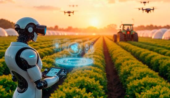
UAV Drone Remote Sensing Systems
UAV (Unmanned Aerial Vehicle) drone remote sensing systems have democratized access to high-resolution, real-time data collection. Equipped with multispectral or thermal sensors, drones are increasingly used in:
- Monitoring large agricultural fields.
- Surveying construction projects.
- Detecting heat leaks in industrial plants.
- Mapping disaster zones after environmental events.
Their low operational cost, flexibility, and ability to access remote or hazardous areas make UAVs indispensable for modern industries.
Satellite Remote Sensing Data Analytics: Transforming Industries
Satellites orbiting Earth continuously gather vast amounts of environmental data. Through satellite remote sensing data analytics, this data is transformed into meaningful information that fuels innovation and efficiency.
In industrial use, satellite data supports:
- Predictive maintenance of assets.
- Monitoring deforestation and land reclamation.
- Tracking urban expansion and infrastructure development.
- Detecting oil spills or thermal anomalies.
For agriculture, satellites provide crucial insights into crop growth cycles, drought conditions, and pest infestations. Platforms combining AI and machine learning further enhance satellite remote sensing data analytics by automating image classification and pattern detection.
Remote Sensing Technologies for Industry
Industries across the globe leverage remote sensing technologies for industry to enhance productivity and sustainability. Key sectors include:
- Energy and Utilities: Monitoring solar farms, wind turbine health, and pipeline integrity.
- Mining: Mapping mineral deposits and monitoring environmental impacts.
- Construction and Urban Planning: Analyzing land use patterns and structural changes.
- Oil and Gas: Using active remote sensing services industry tools like LiDAR to detect surface deformations and subsurface features.
- Transportation: Planning routes, assessing traffic patterns, and monitoring infrastructure degradation.
The integration of remote sensing GIS integration with industrial management systems allows decision-makers to visualize spatial trends, optimize operations, and minimize environmental footprints.
Remote Sensing Applications in Agriculture
Agriculture is one of the biggest beneficiaries of modern remote sensing. Remote sensing applications in agriculture are helping farmers transition from traditional to precision-based practices.
Key applications include:
- Crop Monitoring: Satellite and UAV imagery help track crop vigor, moisture, and disease spread.
- Soil Mapping: Identifying soil types, salinity levels, and nutrient status to optimize fertilization.
- Irrigation Management: Monitoring evapotranspiration and soil moisture to guide water usage.
- Yield Prediction: Using multispectral data and AI models to forecast productivity.
- Pest and Disease Management: Detecting early signs of stress before visible symptoms appear.
With global food demand rising, remote sensing is enabling sustainable agriculture by improving resource management and reducing waste.
Remote Sensing GIS Integration: The Power of Spatial Intelligence
Remote sensing GIS integration brings together the spatial mapping power of Geographic Information Systems (GIS) with the data richness of remote sensing. This combination enables layered visualization of environmental, industrial, and agricultural parameters.
For instance:
- In urban development, GIS-integrated remote sensing supports smart city planning.
- In agriculture, it maps crop health across regions and seasons.
- In energy and mining, it visualizes resource distribution and environmental impacts.
By integrating remote sensing data into GIS platforms, users can perform spatiotemporal analyses, identify patterns, and create predictive models for better decision-making.
Industry Remote Sensing for Environmental Monitoring
Environmental monitoring is a major driver of remote sensing innovation. Industry remote sensing for environmental monitoring plays a critical role in assessing air quality, water pollution, and land degradation.
Applications include:
- Detecting greenhouse gas emissions.
- Monitoring forest cover and deforestation rates.
- Tracking coastal erosion and marine health.
- Evaluating the environmental impact of industrial activities.
Regulatory bodies and private industries rely on this data to ensure compliance, sustainability reporting, and proactive risk management. As climate change accelerates, remote sensing’s contribution to environmental monitoring is becoming increasingly vital.
Active Remote Sensing Services Industry: Driving Precision and Control
The active remote sensing services industry refers to technologies that emit their own energy signals (such as radar or LiDAR) to detect and measure Earth’s features. Unlike passive systems that rely on sunlight, active sensors work day or night and through clouds.
Applications in industry include:
- Structural health monitoring through radar interferometry.
- Mapping surface deformation in mining or construction.
- Tracking sea ice movements and maritime navigation.
- Monitoring forest biomass and vegetation structure.
These active remote sensing services provide high-precision, continuous data streams essential for industries where timing and accuracy are critical.
Integrating AI and Big Data in Remote Sensing
The exponential growth of data from satellites, drones, and sensors demands advanced analytical solutions. Artificial intelligence (AI) and big data analytics have transformed remote sensing technologies by automating image classification, anomaly detection, and predictive modeling.
- Machine Learning Algorithms: Classify land cover types and detect patterns.
- Deep Learning Models: Analyze hyperspectral and LiDAR datasets for enhanced feature extraction.
- Cloud Computing Platforms: Enable real-time processing of massive datasets from global sensors.
This integration accelerates decision-making, reduces human error, and enables industries to act on insights in near-real-time.
The Future of Remote Sensing Technologies
The future of remote sensing technologies for industry and agriculture lies in convergence. The blending of satellite, UAV, and ground-based systems, powered by AI, will create seamless data ecosystems.
Emerging trends include:
- Edge AI for Drones: Real-time decision-making during flight.
- Miniaturized Sensors: Affordable, portable, and efficient remote sensing devices.
- Quantum Remote Sensing: Leveraging quantum mechanics for ultra-precise measurements.
- Blockchain Data Security: Ensuring authenticity and traceability of remote sensing data.
As sustainability becomes a global priority, industries and farmers will increasingly rely on these technologies for efficient resource management and environmental stewardship.
Conclusion
From LiDAR remote sensing applications in infrastructure to hyperspectral imaging remote sensing in agriculture, the possibilities are vast and continually expanding. Satellite remote sensing data analytics and UAV drone remote sensing systems now form the backbone of smart industries and precision agriculture.
By embracing remote sensing GIS integration and industry remote sensing for environmental monitoring, organizations can achieve unprecedented accuracy, sustainability, and operational efficiency. The combination of active and passive systems under the active remote sensing services industry umbrella is paving the way for a future where every sector—industrial or agricultural—operates with intelligence drawn directly from the Earth’s surface.
Remote sensing isn’t just technology; it’s the foundation for a smarter, cleaner, and more sustainable world.
More Articles
 22 Apr 2026
Free Website Builders 2026 | Best No-Code Platforms
Launch a stunning site today using the best free website builders 2026. Compare top free website builder platforms and go live in minutes.
 22 Apr 2026
Khmer Typing Apps 2026 | Best for Android & iPhone
Khmer typing apps for Android and iPhone in 2026, featuring best keyboards and smart typing tools for easy communication.
 21 Apr 2026
Passive Income Ideas Online 2026 | Earn from Home Guide
The best passive income ideas online in 2026. Learn how to make passive income online step by step, including beginner-friendly strategies to earn passive income from home with or without investment.
 21 Apr 2026
How to Grow TikTok Followers Fast 2026 | Viral Tips
Learn how to grow TikTok followers fast in 2026 with proven strategies, viral tips, and organic growth techniques for long-term success.